


Polar Vortex
Sources: National Weather Service and Climate.gov
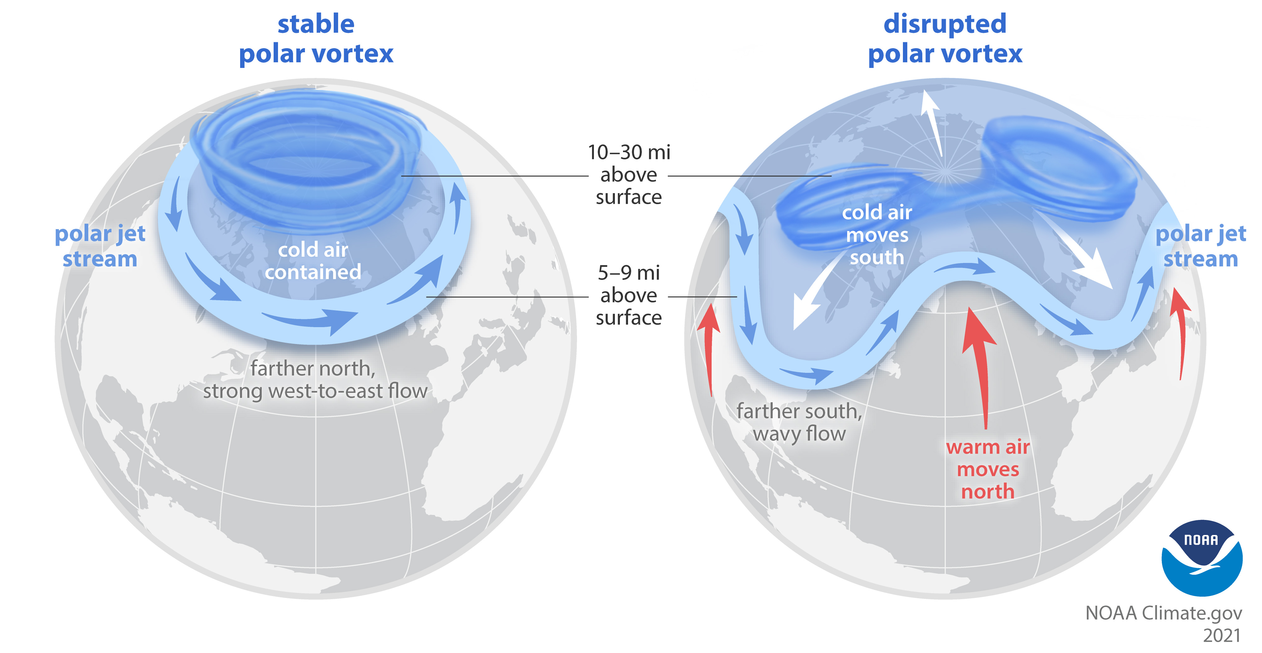
The Arctic polar vortex is a strong band of winds in the stratosphere, surrounding the North Pole 10-30 miles above the surface. It ALWAYS exists near the poles, but weakens in summer and strengthens in winter. The polar vortex is far above the polar jet stream, the flow of winds in the troposphere 5-9 miles above the surface.
The term "vortex" refers to the counter-clockwise flow of air that helps keep the colder air near the Poles. Many times during winter in the northern hemisphere, the polar vortex will expand, sending cold air southward with the jet stream (see graphic above). This occurs during wintertime and is often associated with large outbreaks of Arctic air in the United States.
When the polar vortex is especially strong and stable, the jet stream stays farther north and has fewer "kinks." This keeps cold air contained over the Arctic and the mid-latitudes warmer than usual. Every other year or so, the Arctic polar vortex dramatically weakens. The vortex can be pushed off the pole or split into two. Sometimes the polar jet stream mirrors this strato-spheric upheaval, becoming weaker or wavy. At the surface, cold air is pushed southward to the mid-latitudes, and warm air is drawn up into the Arctic.
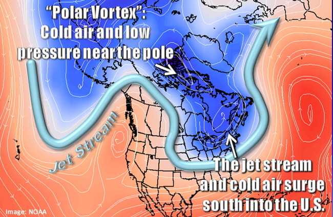
Polar vortexes are not something new. The term "polar vortex" has only recently been popularized, bringing attention to a weather feature that has always been present. It is also not a feature that exists at the Earth's surface. Weather forecasters examine the polar vortex by looking at conditions tens of thousands of feet up in the atmosphere; however, when we feel extremely cold air from the Arctic regions at Earth's surface, it is sometimes associated with the polar vortex. This is not confined to the United States. Portions of Europe and Asia also experience cold surges connected to the polar vortex.