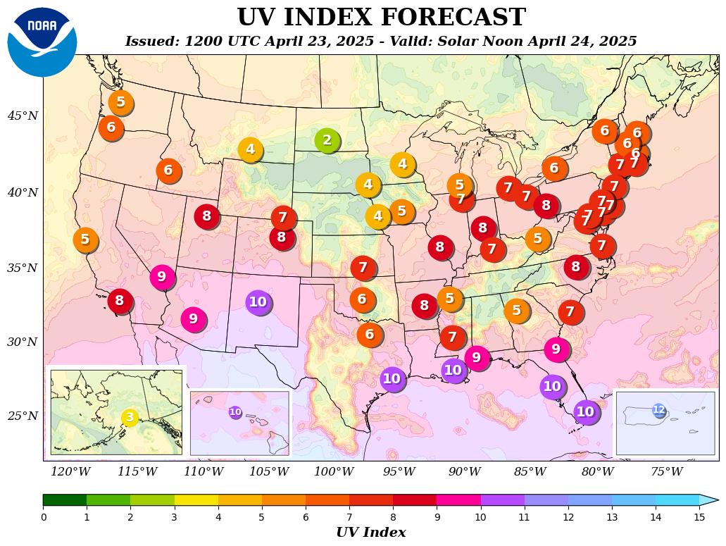
UV Index Forecast
The 6-day forecast of the UV index below is for the 0.25° by 0.25° grid cell that contains Santa Fe NM at local solar noon assuming clear-sky conditions and in the absence of snow.
| Thu | Fri | Sat | Sun | Mon | Tue |
| 11.7 | 11.3 | 11.2 | 11.5 | 11.9 | 11.6 |
| Extreme | Extreme | Extreme | Extreme | Extreme | Extreme |
UV forecast courtesy of and Copyright © KNMI/ESA (http://www.temis.nl/). Used with permission.
Use the widget below to check the UV Index for your location.
UV Index Today provides national and local UV index forecasts for 40,000+ cities in the United States. The forecasts include the real-time UV index, the hourly UV index, and the UV Index forecast for the next five days. Forecasts are built using data provided by NOAA.
Below is an overview of the UV Index for 58 major cities in the United States produced by the Climate Prediction Center.
Exposure Minutes to Get a Sunburn
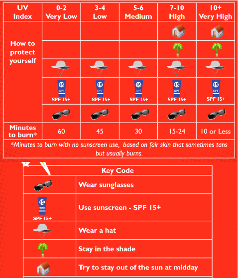
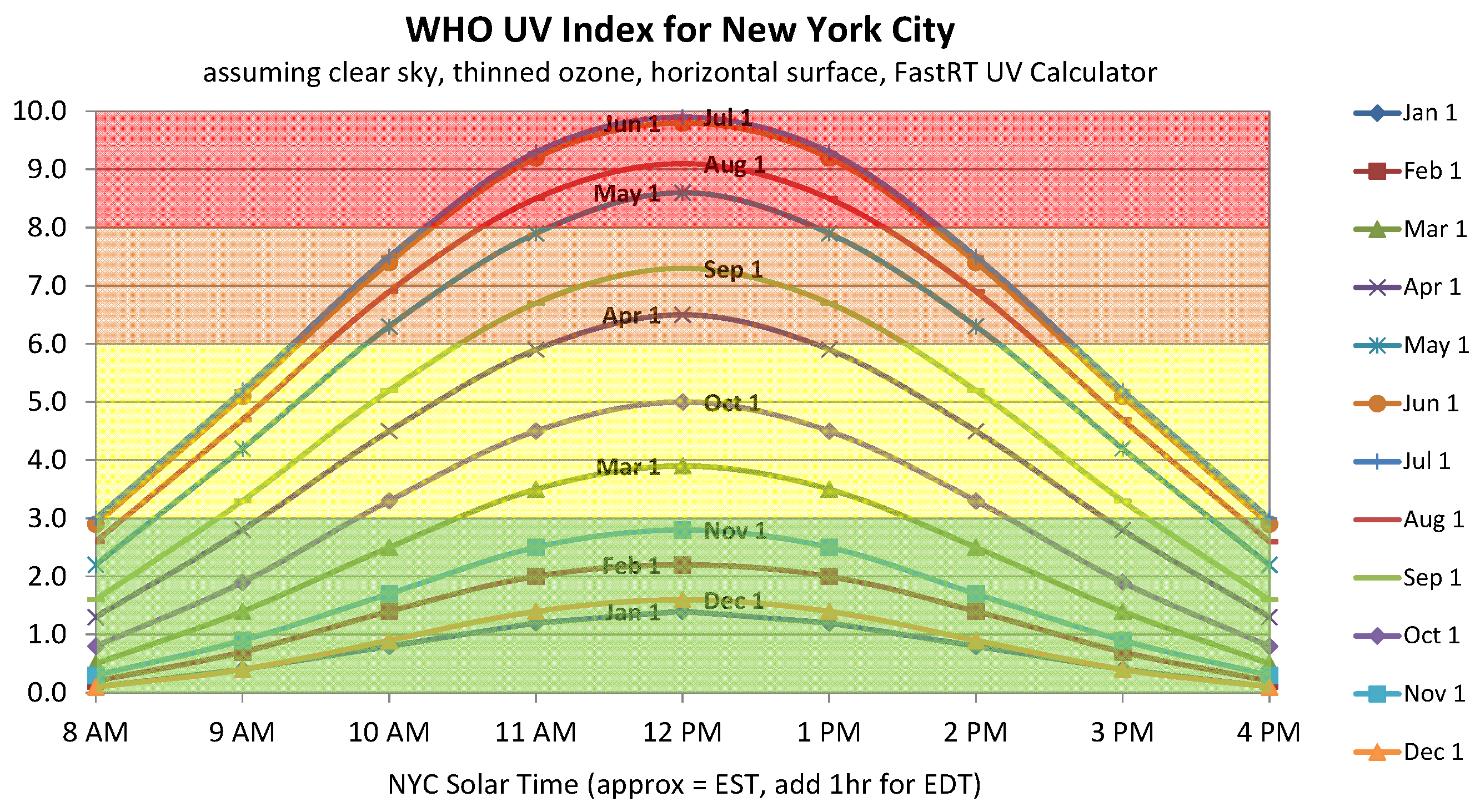
The UV index you see reported is usually the daily maximum - that's the highest it will be all day. How high it gets depends on lots of factors, including your location, the time of year, the time of day, the amount of cloud cover, and ozone and pollution in the atmosphere. The index tends to be higher closer to the Equator and at high altitudes, as the sunlight has to pass through less air before it reaches the ground. The UV Index will change during the day and year as the angle of sun changes as illustrated below.
By Patrug - Own work, CC BY-SA 3.0, https://commons.wikimedia.org/w/index.php?curid=33455958
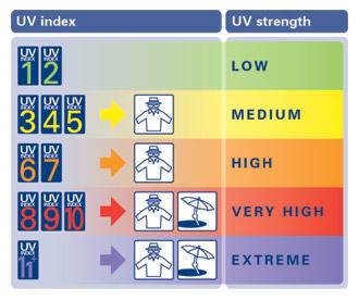
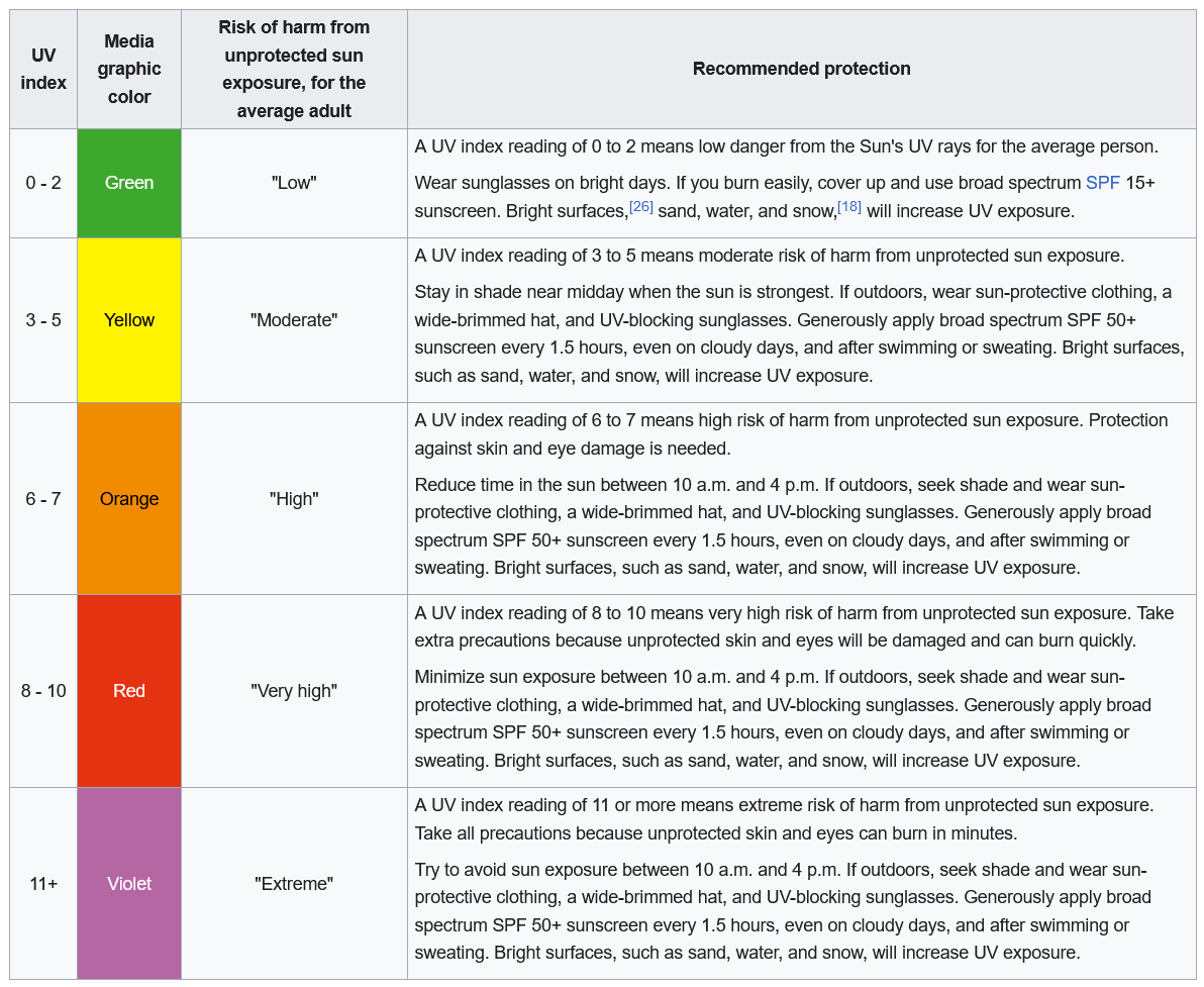
A more detailed description of UV color codes is shown below.
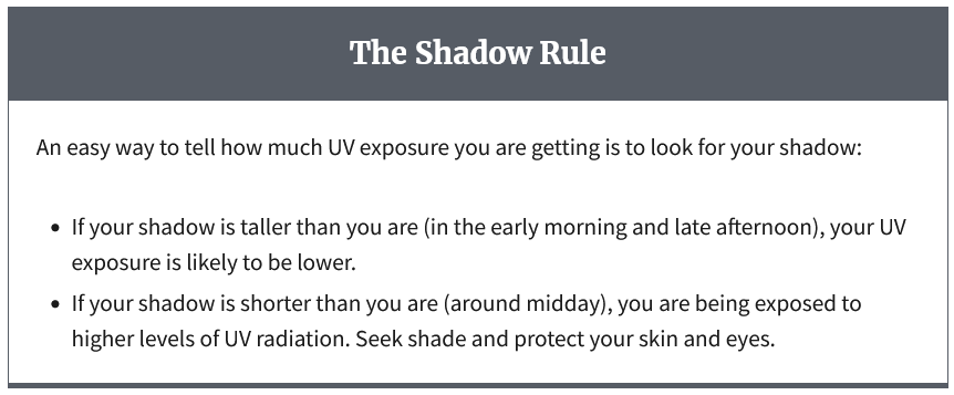
An easy way to tell how much UV exposure you are getting is to look for your shadow.