


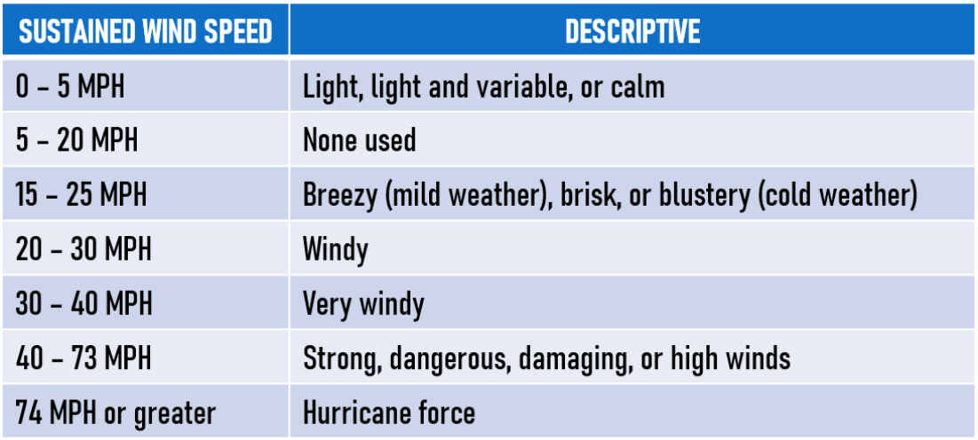
Wind Measures
Meterologists will discribe the wind forecast with the prevailing direction from which the wind is blowing with speeds in miles per hour.
Beaufort Wind Scale
The Beaufort Wind Scale was long in use as a system for estimating wind speeds. It was introduced in 1806 by Admiral Sir Francis Beaufort (1774-1857) of the British navy to describe wind effects on a fully rigged man-o-war sailing vessel, and it was later extended to include descriptions of effects on land features as well. Today the accepted international practice is to report wind speed in knots (1 knot equals about 1.85 km, or 1.15 mi, per hour).
The Beaufort Wind Scale is divided into a series of values, from 0 for calm winds to 12 and above for hurricanes. Each value represents a specific range and classification of wind speeds with accompanying descriptions of the effects on surface features.
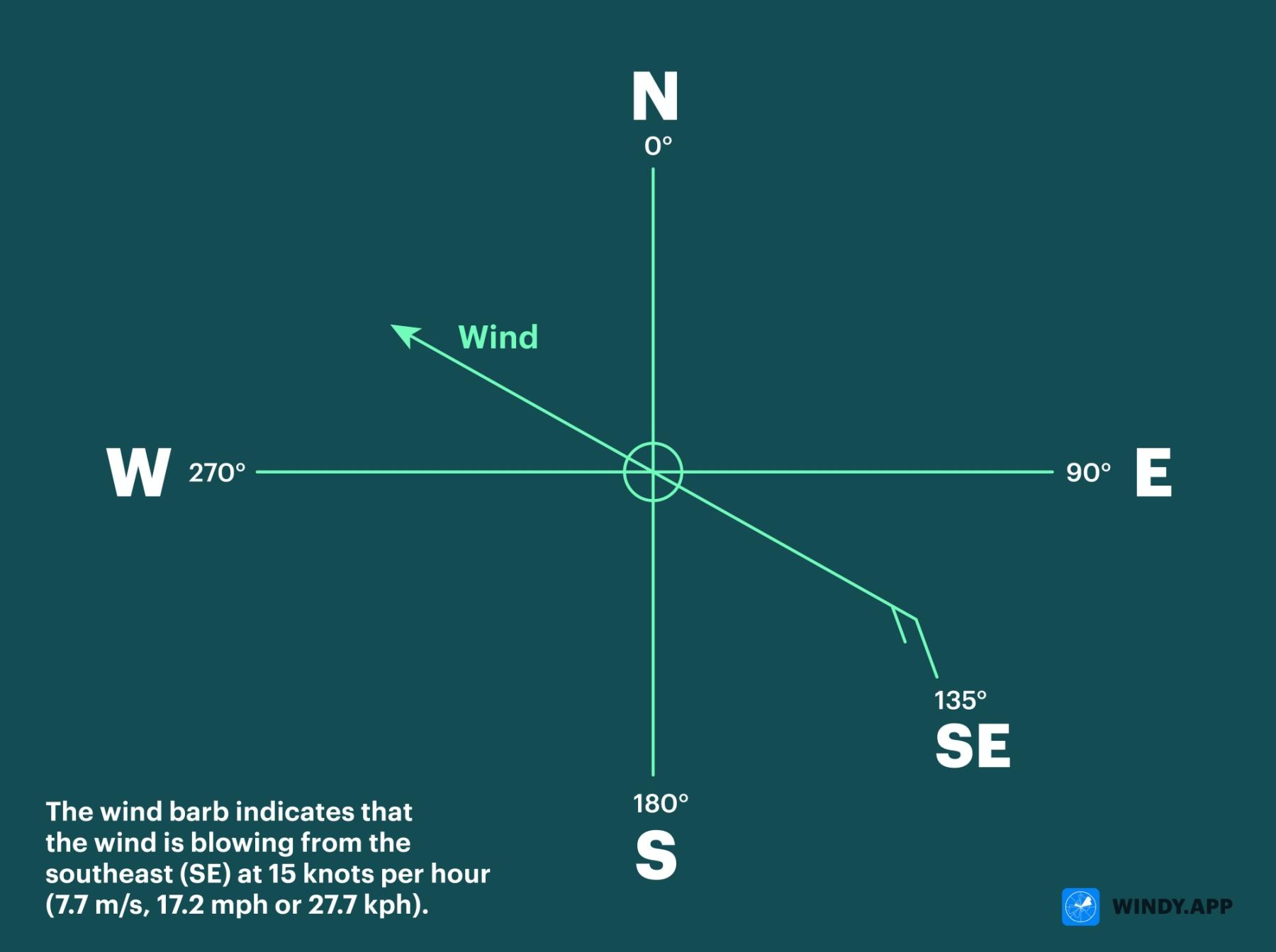
Wind Barbs
Wind Barbs are symbols on the map that show wind direction and speed at some specified location. It is a familiar format for displaying the wind to all meteorogists, yachtmen, and others. That's how it were drawn on the synoptic maps before, and so many people are used to seeing it. Wind Barbs are now ofter displayed on digital maps, as well.
Below is a simple description of a Wind Barb.
Windsock
A windsock (a wind cone or wind sleeve) is a conical textile tube can be used as a basic indicator of wind speed and direction. Windsocks are typically used at airports to show the direction and strength of the wind to pilots, and at chemical plants where there is risk of gaseous leakage. They are also sometimes located alongside highways at windy locations.
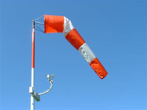
Wind directions are conventionally specified as the compass point from which the wind originates, so a windsock pointing due north indicates a southerly wind. Wind speed is indicated by the windsock's angle relative to the mounting pole—in low winds it droops; in high winds, it flies horizontally. Per FAA standards, a properly functioning windsock orients itself to a breeze of at least 3 knots (5.6 km/h; 3.5 mph) and fully extends in a wind of 15 knots (28 km/h; 17 mph).